 INSPIRE-1
Provided by
Type of resources
Available actions
Topics
Keywords
Contact for the resource
Update frequencies
Service types
-
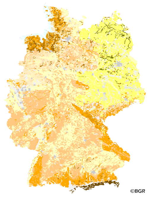
Compilation of the European Pre-Quaternary marine geology (section of Germany). Project partners are the national geological services of the participating countries. The map consists of data at highest available spatial resolution, map scale („multi-resolution“-concept) and data completeness vary depending on the project partner (as of 2016 September). According to the Data Specification on Geology (D2.8.II.4_v3.0) the content of the geological map is stored in a INSPIRE-compliant GML file: EMODnet-DE_Pre-Quaternary_GeologicUnit.gml contains the geologic units. The GML files together with a Readme.txt file are provided in ZIP format (EMODnet-DE_Pre-Quaternary-INSPIRE.zip). The Readme.text file (German/English) contains detailed information on the GML file content. Data transformation was proceeded by using the INSPIRE Solution Pack for FME according to the INSPIRE requirements.
-
View service (WMS)
-
Download service (WFS)
-
The map Organic Matter Content of Top-Soils in Germany 1:1,000,000 highlights the results of a Germany-wide compilation of typical soil organic matter contents in top-soils differentiated according to 15 groups of soil parent material, four climatic areas and the main land use. The evaluation is based on more than 9000 soil data profiles with information about Soil Organic Matter (SOM) from a period of about 20 years. The report 'The Organic Matter Content of Top-Soils in Germany', BGR Archiv, No. 0127036 (in German) documents the methodology. The classes of the map legend are based on the classes given in the German Soil Mapping Guideline, 5th Edition (KA5).
-
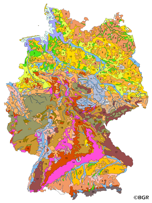
The BUEK5000 is derived form the landuse stratified soil map of Germany at scale 1:1,000,000 by aggregation, focused on information about the parent material, and generalization. The maps shows 20 soil (23) legend units with polygons of at least 64 square kilometers.
-
-
-
Download service (ATOM feed)
-
-
