 INSPIRE-1
cl_maintenanceAndUpdateFrequency
continual
5744 record(s)
Provided by
Type of resources
Available actions
Topics
Keywords
Contact for the resource
Update frequencies
Service types
-

-
-

-
-

-

-
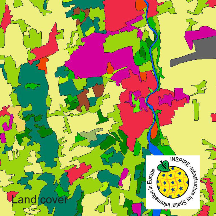
This dataset clc5 (2018) describes the landscape according to the CORINE Land Cover (CLC) nomenclature. These classes contain mainly information about landcover mixed with some aspects of landuse. CLC5 is based on the more detailed German landcover model from 2018 (LBM-DE2018) which uses separate classes for landcover and landuse and attribute-information about percentage of vegetation and sealing. The mimimum unit for an object is 1 ha. For the CLC5 dataset landcover and landuse classes are combined to unique CLC-classes taking into account the percentage of vegetation and sealing , followed by a generalisation process.
-
This dataset clc5 (2012) describes the landscape according to the CORINE Land Cover (CLC) nomenclature. These classes contain mainly information about landcover mixed with some aspects of landuse. CLC5 is based on the more detailed German landcover model from 2012 (LBM-DE2012) which uses separate classes for landcover and landuse and attribute-information about percentage of vegetation and sealing. The mimimum unit for an object is 1 ha. For the CLC5 dataset landcover and landuse classes are combined to unique CLC-classes taking into account the percentage of vegetation and sealing , followed by a generalisation process.
-
This dataset clc5 (2015) describes the landscape according to the CORINE Land Cover (CLC) nomenclature. These classes contain mainly information about landcover mixed with some aspects of landuse. CLC5 is based on the more detailed German landcover model from 2015 (LBM-DE2015) which uses separate classes for landcover and landuse and attribute-information about percentage of vegetation and sealing. The mimimum unit for an object is 1 ha. For the CLC5 dataset landcover and landuse classes are combined to unique CLC-classes taking into account the percentage of vegetation and sealing , followed by a generalisation process.
-
INSPIRE theme Environmental Monitoring Facilities. The data of the Marine Environmental Monitoring Network contain information on water temperature, salinity, level and current at different depths, air temperature, wind speed and direction, air pressure, humidity of the North and Baltic Sea at the stations Darßer Schwelle, Ems, Fehmarn Belt, Nordseeboje lll, Nordseeboje ll, Arkona Basin, German Bight, Fino 1, Kiel, Oder Bank.