 INSPIRE-1
Keyword
genesis
17 record(s)
Provided by
Type of resources
Available actions
Topics
Keywords
Contact for the resource
Service types
-
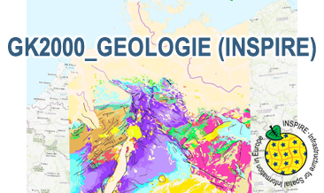
The WMS GK2000 Geologie (INSPIRE) represents the surface geology of Germany and adjacent areas on a scale of 1:2,000,000. According to the Data Specification on Geology (D2.8.II.4_v3.0) the geological map provides INSPIRE-compliant data. The WMS GK2000 Geologie (INSPIRE) contains layers of the geologic units (GE.GeologicUnit), faults (GE.GeologicFault) and marginal position of the ice shield as well as the impact craters Nördlinger Ries and Steinheimer Becken (GE. GeomorphologicFeature) displayed correspondingly to the INSPIRE portrayal rules. The geologic units are represented graphically by stratigraphy (GE.GeologicUnit.AgeOfRocks) and lithology (GE.GeologicUnit.Lithology). For different geochronologic minimum and maximum ages, Upper Devonian - Permian, the portrayal is defined by the colour of the geochronologic minimum age (olderNamedAge). In case of the geologic units the user obtains detailed information via the getFeatureInfo request on the lithology, stratigraphy (age) and genesis (event environment and event process).
-
The GK2000 Geologie (INSPIRE) represents the surface geology of Germany on a scale of 1:2,000,000. According to the Data Specification on Geology (D2.8.II.4_v3.0) the content of the geological map is stored in three INSPIRE-compliant GML files: GK2000_Geology_GeologicUnit.gml contains the geologic units, GK2000_Geology_GeologicStructure.gml comprises the faults and GK2000_Geology_GeomorphologicFeature.gml represents the marginal position of the ice shield as well as the impact craters Nördlinger Ries and Steinheimer Becken. The GML files together with a Readme.txt file are provided in ZIP format (GK2000_Geologie-INSPIRE.zip). The Readme.text file (German/English) contains detailed information on the GML files content. Data transformation was proceeded by using the INSPIRE Solution Pack for FME according to the INSPIRE requirements.
-
The GK2750 Geology (INSPIRE) represents the surface geology of Germany and adjacent areas on a scale of 1:2,750,000. According to the Data Specification on Geology (D2.8.II.4_v3.0) the content of the geological map is stored in three INSPIRE-compliant GML files: GK2750_GeologicUnit.gml contains the geologic units, GK2750_GeologicStructure.gml comprises the faults and GK2750_NaturalGeomorphologicFeature.gml represents the marginal position of the ice shield and the impact crater Nördlinger Ries. The GML files together with a Readme.txt file are provided in ZIP format (GK2750-INSPIRE.zip). The Readme.text file (German/English) contains detailed information on the GML files content. Data transformation was proceeded by using the INSPIRE Solution Pack for FME according to the INSPIRE requirements.
-
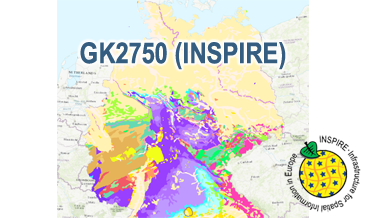
The WMS GK2750 Geology (INSPIRE) represents the surface geology of Germany on a scale of 1:2,750,000. According to the Data Specification on Geology (D2.8.II.4_v3.0) the geological map provides INSPIRE-compliant data. The WMS GK2750 Geology (INSPIRE) contains layers of the geologic units (GE.GeologicUnit), faults (GE.GeologicFault) and marginal position of the ice shield and the impact crater Nördlinger Ries (GE. GeomorphologicFeature) displayed correspondingly to the INSPIRE portrayal rules. The geologic units are represented graphically by stratigraphy (GE.GeologicUnit.AgeOfRocks) and lithology (GE.GeologicUnit.Lithology). For different geochronologic minimum and maximum ages, e.g. Upper Devonian - Permian, the portrayal is defined by the colour of the geochronologic minimum age (olderNamedAge). In case of the geologic units the user obtains detailed information via the getFeatureInfo request on the lithology, stratigraphy (age) and genesis (event environment and event process).
-
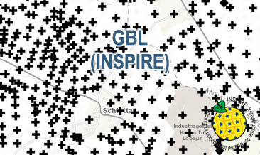
The WMS GBL (INSPIRE) represents mechanically drilled boreholes approved by the State Geological Surveys of Germany (SGS). Most of the drilling data were not collected by the SGS, but were transmitted to the SGS by third parties in accordance with legal requirements. Therefore, the SGS can accept no responsibility for the accuracy of the information. According to the Data Specification on Geology (D2.8.II.4_v3.0) the map provides INSPIRE-compliant data. The WMS GBL (INSPIRE) contains a layer of the boreholes (GE.borehole) displayed correspondingly to the INSPIRE portrayal rules. The boreholes are represented graphically by the borehole purpose. Via the getFeatureInfo request the user obtains detailed information on the boreholes.
-
.png)
The WMS GK1000 (INSPIRE) represents the surface geology of Germany and adjacent areas on a scale of 1:1,000,000. According to the Data Specification on Geology (D2.8.II.4_v3.0) the geological map provides INSPIRE-compliant data. The WMS GK1000 (INSPIRE) contains layers of the geologic units (GE.GeologicUnit), faults (GE.GeologicFault) and marginal position of the ice shield (GE. NaturalGeomorphologicFeature) displayed correspondingly to the INSPIRE portrayal rules. The geologic units are represented graphically by stratigraphy (GE.GeologicUnit.AgeOfRocks) and lithology (GE.GeologicUnit.Lithology). For different geochronologic minimum and maximum ages, e.g. Carboniferous - Permian, the portrayal is defined by the color of the geochronologic minimum age (olderNamedAge). The portrayal of the lithology is defined by the rock or rock group representing the main part of the lithological composition of the geologic unit. In case of the geologic units the user obtains detailed information via the getFeatureInfo request on the lithology, stratigraphy (age) and genesis (event environment and event process).
-
The GBL (INSPIRE) represents mechanically drilled boreholes approved by the State Geological Surveys of Germany (SGS). Most of the drilling data were not collected by the SGS, but were transmitted to SGS by third parties in accordance with legal requirements. Therefore, the SGS can accept no responsibility for the accuracy of the information. According to the Data Specification on Geology (D2.8.II.4_v3.0) the boreholes of each federal state are stored in one INSPIRE-compliant GML file. The GML file together with a Readme.txt file is provided in ZIP format (e.g. GBL-INSPIRE_Lower_Saxony.zip). The Readme.txt file (German/English) contains detailed information on the GML file content. Data transformation was proceeded by using the INSPIRE Solution Pack for FME according to the INSPIRE requirements.
-
The GK1000 (INSPIRE) represents the surface geology of Germany and adjacent areas on a scale of 1:1,000,000. According to the Data Specification on Geology (D2.8.II.4_v3.0) the content of the geological map is stored in three INSPIRE-compliant GML files: GK1000_GeologicUnit.gml contains the geologic units, GK1000_GeologicStructure.gml comprises the faults and GK1000_NaturalGeomorphologicFeature.gml represents the marginal position of the ice shield. The GML files together with a Readme.txt file are provided in ZIP format (GK1000-INSPIRE.zip). The Readme.text file (German/English) contains detailed information on the GML files content. Data transformation was proceeded by using the INSPIRE Solution Pack for FME according to the INSPIRE requirements.
-
The GBL (INSPIRE) represents mechanically drilled boreholes approved by the State Geological Surveys of Germany (SGS). Most of the drilling data were not collected by the SGS, but were transmitted to SGS by third parties in accordance with legal requirements. Therefore, the SGS can accept no responsibility for the accuracy of the information. According to the Data Specification on Geology (D2.8.II.4_v3.0) the boreholes of each federal state are stored in one INSPIRE-compliant GML file. The GML file together with a Readme.txt file is provided in ZIP format (e.g. GBL-INSPIRE_Lower_Saxony. zip). The Readme.txt file (German/English) contains detailed information on the GML file content. Data transformation was proceeded by using the INSPIRE Solution Pack for FME according to the INSPIRE requirements.